Thursday, December 30, 2010

911 on Google Maps

Incident1

Incident1 uses Google Maps to plot police, fire, and emergency incidents from around the nation. The map shows the most recent incidents for your area.

Incident1 shows data from multiple agencies on one map, and it lets you search by zip code and region.

Gothamist NYC Incident Map

The Gothamist uses Google Maps to plot the locations of crimes, fires, accidents and other incidents in New York City. Think of it as police scanner chat.. mapped. Map pins include police, fire and 'exclamation point signs'.

IncidentLog

If you live in New England you can view the latest New England incidents on this Google Map. You can search the map by state, city or street name.

Seattle 911 Calls

This site uses live data publicly available on the Seattle Fire Dept. web site to show Seattle 911 calls live on Google Maps.

Fire Incident Map
The City of Nanaimo have integrated their Fire Incident Report with Google Maps. This allows the citizens of Nanaimo (or anyone else) to query the city’s Fire Incident Report and see the results on a map. The map shows the location of incidents and the apparatus that the fire deployment deployed.

________________

Labels: ,

OpenTripPlanner Portland

A trip planner with a difference

"A trip planner helps you figure out how best to get where you want to go. A multi-modal trip planner lets you plan routes using multiple "modes," for example, on foot, bike, train, bus, or some combination thereof. A good multi-modal trip planner allows you to easily tailor your trip to your preferences, for example by eliminating transfers, walking a more scenic path, or only riding buses with bike storage."

What is OpenTripPlanner?

OpenTripPlanner is an open source multi-modal trip planner. It brings together work from a number of existing open source projects, including Graphserver, OneBusAway, and FivePoints, and aims to be easy-to-use, flexible, reliable, and fast.

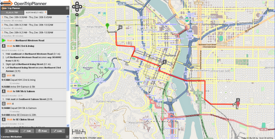
OpenTripPlanner Portland
Planning a trip is very straightforward - right click to create start point and right click to add destination.
OpenTripPlanner Portland Route
Lots of Options - like Transit only - with changes includes - clearly laid-out.


For Developers
  • Plans true multi-modal trips combining walking, biking and transit
  • Plans wheelchair accessible trips
  • Plans depart by/arrive by trips
  • Takes road type, bike lane, and elevation data into account when planning bike trips
  • Show elevation maps for bike trips
  • Imports data from GTFS, shapefiles, OpenStreetMap, and the National Elevation Dataset
  • Plans trips in about 100ms in a moderate sized city
  • Exposes a RESTful API (XML and JSON), which other apps or front-ends can build on

Try the OpenTripPlanner for Portland
http://maps5.trimet.org/otp/

wiki for developers
http://opentripplanner.org/wiki

Labels: , , ,

More great models from Andy Dell

Back in August, we showed you some of the great 3D models that Andy Dell was creating in Hounslow, and more recently we showed you some of the great 3D models found on the grounds of the Hampton Court Palace in London.

As it turns out, Andy has been building a lot of other models in that same area of London. The models aren't yet in Google Earth, but they're all available in the 3D Warehouse. As you can see below, the buildings look excellent and are very well built.

Here's some of what he has been working on:

Hampton Court Main Gates -- 3D Warehouse -- KML

1-main-gates.jpg

Bushy Park Entrance -- 3D Warehouse -- KML

2-bushy-park.jpg

King Arms Hotel -- 3D Warehouse -- KML

3-king-arms.jpg

Liongate Hotel -- 3D Warehouse -- KML

4-liongate.jpg

Along with those models, he's done a good bit of work in nearby Thorpe Park. He's built a variety of buildings in the park:

5-thorpe-park1.jpg

And even some of the rides!

6-thorpe-park2.jpg

You can view all of those items in this collection in the 3D Warehouse.

Great work, Andy!

George Clooney's Eye on Sudan

Satellite Sentinel Project

A joint project by the U.N.'s Operational Satellite Applications Programme, Harvard University and the Enough Project hopes to stop the tensions between South and North Sudan developing into war.

Inspired by an idea by George Clooney and John Prendergast the project is buying satellite imagery to monitor troop movements in the region. George Clooney says that using satellite imagery,

"We can witness in near real-time and put all parties on notice that if they commit war crimes, we will all be watching, and pressuring policymakers to take action."

The Satellite Sentinel Project has developed a mapping system which will combine satellite imagery analysis and field reports with Google Maps to help deter the resumption of war between North and South Sudan.

________________

Labels: