Google is working with the automotive industry to bring Google innovations and services into cars, and to give our users access to relevant information while driving. BMW has always been a pioneer in this area, and well known for its Internet-connected cars and ConnectedDriveproduct.
Today, we’re happy to announce that in a joint effort with BMW, we have renewed the package of Google services that come with BMW’s ConnectedDrive service. As part of this major update, if you’re a ConnectedDrive customer in Germany, Austria, France, Italy and the U.K., you’ll have access to several exciting Google services you’ve never before experienced in a car.
BMW is introducing these services in every new car equipped with a professional navigation system as of September 2010.

So what’s new?
Firstly, we’re introducing search suggestions for Google Local Search.
We know that input mechanisms in your vehicle are sometimes limited and time-consuming. To enter a search query, you often need to know exactly what you’re looking for.
To address this challenge, cars with our new service package will provide suggested results after you enter the first few characters - similar to what you’re used to on Google’s desktop web search. Suggestions are based on your location and will surely speed up your search. Once you’ve tried this in your car, you’ll never want to leave home any other way!

With only a couple of characters, you’ll be guided to the information you want that has been fully integrated in your navigation experience. How about finding the nearest hotel with only a few keystrokes and a bit of ”jog-wheeling”?

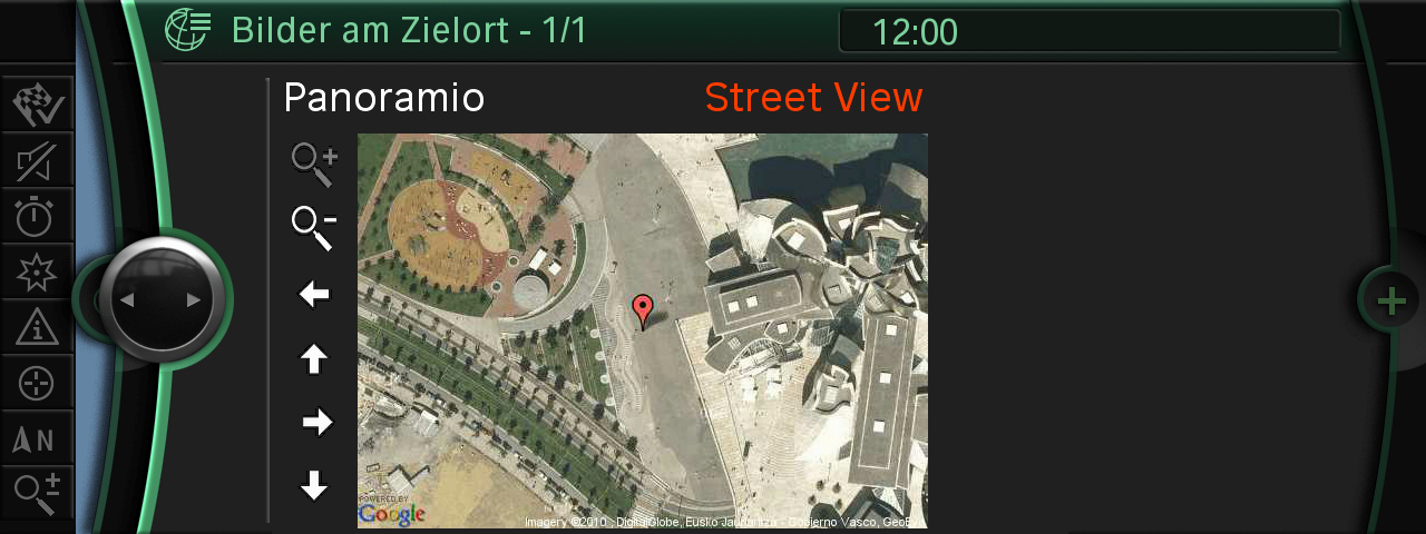
Secondly, we’re beefing up the usefulness of your results via a “pictures at your destination” service that gives you much richer details about the location you’ve entered into the system.
For each search result, Google Local Search already provides helpful information such as a place’s address, phone number, ratings, reviews, various business attributes, etc.
But we get that you might want even more, and are now enabling you to have an advance look at the destination you’re going. “Pictures at your destination” is a new service that combines images of your destination from various online sources. Where available, you’ll see satellite imagery, user generated photos from the Panoramio community, or even Street View imagery that gives you a sense of what you can visually expect when you get to your destination.
Have a look:


Thirdly and as always, we’re continuing to make improvements to our Local Search offering. Google Local Search is already available in many cars worldwide and has become a very useful complimentary service to static-only point of interest (POI) searches from DVDs or hard drives. By taking advantage of the rich information and fresh data this technological integration allows, we hope searching for places in your car makes it faster, easier and more exciting for you to get where you’re going.
Enjoy your connected drive, and stay tuned for more great car services from the Google automotive team and our partners!


 1 -- Native support for iPhone4 and Retina display:Google Earth is now incredibly sharp and detailed on the iPhone 4.
