Saturday, June 19, 2010

Let Pegman guide you to user photos


Tuesday, June 15, 2010 at 9:05 AM

You may be familiar with the photos layer on Google Maps - it’s a great way to explore user generated photos from countries all over the world right within Google Maps. Over the last couple of years since launching this layer we’ve made various improvements so people can explore them more easily. Like being able to slide from a gorgeous view along the bank of the Seine at dawn to another at sunset, simply by clicking the dots. Today we have another great way you can take that round the world trip you always wanted.

Remember Pegman, the little orange man that you can drag and drop on to the map to jump into Street View images? As of today, he has a new trick up his sleeve. He’s becoming our official photo tour guide, helping you not only navigate our Street View imagery where it’s available, but also helping to highlight the amazing geo-located photos the Panoramio photo community has contributed, as well as public images from Picasa and Flickr. There are images from pretty much every corner of the globe, so there is almost no end of sights and scenes to keep you busy.

When you drag Pegman, you will now see small blue dots to show where user-contributed photos are available (they look a bit like the squares you see on our Wikipedia layer on maps).


If you drag Pegman over one of the blue dots, you get to see a preview of a photo taken at that location.


Then if you drop Pegman onto one of the blue dots, you will be able to view that image in ourphoto browser, which will let you navigate further into neighbouring pictures.


The photos you can explore this way are the same as those that you can find in the Mapsphoto layer, giving you a full interactive tour. It’s also a great way to explore images taken from places in out-of-the-way locations - say, the top of Half Dome in Yosemite National Park.


Dragging Pegman onto a photo is another handy way to see all the types of images available in Google Maps. So go ahead and let Pegman be your tourguide to parksforestslakes and more.


Properties, now on Google Maps in the UK


Thursday, June 17, 2010 at 1:00 AM

Good news today if you’re house-hunting in Camden Town or Kew Gardens - property search has come to maps.google.co.uk. From today, visitors to maps.google.co.uk will be able to click “Properties...” on the More menu in Maps to see a little red dot on the map showing every house or flat for sale or rent.

The search can be refined by choosing features like sale or rent, bedrooms, bathrooms, and price. The map will update to show the properties matching those criteria - and also dynamically update as you scroll and zoom around the map until you’ve found your dream spot.


Other maps layers and features like Photos, Videos, Satellite, and Earth view can be turned on as well, helping you to explore the property results geographically and get an even better sense for your new neighbourhood.

In a survey conducted just before Google Street View launched across the entire UK, a fifth of those surveyed said they had used the service for househunting [source: YouGov Plc February 2010]. We hope they’ll find this new feature really useful for exploring what’s available in neighbourhoods right across the UK.

The feature is showing hundreds of thousands of listings, from PropertyLiveZooplaEzylet,SmartNewHomesVebraProperty PalSpicer HaartCountrywide, and Zoomf. If you’re an estate agent, take a look at maps.google.co.uk/propertytools for information on how to have your property listings show up on Google Maps.

So have a go today - it’s as easy as typing in “property for sale camden town” and then scrolling around the map to see what meets your criteria. You can find contact details for the estate agent on the ‘Place Page’ that pops up for each listing - you can even add any scheduled open homes to your Google calendar with one click of the mouse. Just don’t try making an offer on London’s most famous home ... we don’t think that one’s for sale.

Helping to unveil the power of statistical data


We know that statistics and geography are closely linked because mapping is a fundamental requirement for the implementation of any census or survey. But what would be the role ofGoogle Map Maker in the world of statistics? Can it make a difference? Google’s Map Maker team has been keen to answer these questions.

Since our contribution to StatCom Africa II in January 2010, our team has embarked on a journey to actively engage with the statistics and mapping community in Africa with the objectives of fostering geospatial innovations adoption and of learning how Map Maker can best support users and serve as a platform to map economic, social, and environmental points of interest.

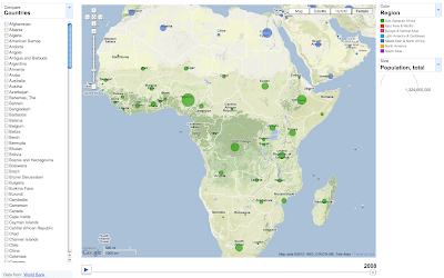
Thus, under the leadership and vision of Dozie Ezigbalike from UNECA, the Map Maker team initiated a Train the Trainers programme in Africa that aims to strengthen the capacity of national organizations in making statistics more accessible, useful, and interesting to the wider public. We do so by tying together technologies -- Google Map Maker, mobile applications, Google Earth and MapsGoogle fusion tables, and Public Data Explorer -- that support data collection, sharing, visualization, and publishing. Jointly with UNECA we have organized Train the Trainers events in Nigeria and Morocco, and trained people at National Statistics Organizations (NSO) from Burundi, Cameroon, DR Congo, Ethiopia, Egypt, Lesotho, Morocco, Nigeria, Senegal, Swaziland, Uganda, and Zambia.


The Morocco Train the Trainer event took place last week in Rabat and brought together forty statistics and mapping professionals from locations around Africa for intensive training on Google geospatial technologies. UNECA and Google put together the event in order to help organizations make mapping and statistical data widely accessible to everyone. The event was capped off with a Mapping Party for students at Ecole Hassania Travaux Publics (EHTP), who will be creating detailed maps for the public.

Take a peek at the photos from the Train the Trainers event that took place last week in Rabat.


We're only in the first steps of our journey of learning together with these communities, but we are already seeing the impact of our work at the UN (UNOSAT work), with universities (Makerere University), and among enthusiastic mappers. Google Map Maker data for Africa and other countries around the world (see complete list here) is publicly available for download for non-commercial use and attribution. Data can be used to do things such as create offline maps, combine data sets, and run analysis. Join the map your world communityfor the latest developments, Map Maker features, discussion with other mappers and sneak previews!


====

Prendre conscience du pouvoir des statistiques

Nous savons tous que les statistiques et la géographie sont étroitement liées, la cartographie étant un élément fondamental de mise en œuvre d’un recensement ou d’une enquête. Mais quel est le rôle de Google Map Maker dans l'univers des statistiques ? Quel peut être l’apport de cet outil ? L’équipe Google de Map Maker a bien voulu répondre à trois questions.

Depuis notre contribution à StatCom Africa II en janvier 2010, notre équipe a décidé de s’engager activement auprès de la communauté des statisticiens et des cartographes en Afrique, dans l’objectif de stimuler l’adoption d’innovations géo-spatiales et d’apprendre comment Map Maker peut mieux aider les utilisateurs et servir de plate-forme pour agréger les informations économiques, sociales et environnementales.

C’est ainsi que, sous la direction et la vision de Dozie Ezigbalike de l’UNECA, l’équipe Map Maker a lancé un programme de Formation de formateurs en Afrique, dans le but de renforcer la capacité des organismes nationaux à rendre les statistiques plus accessibles, plus utiles et plus intéressantes pour un public plus vaste. Pour ce faire, nous relions entre elles les technologies -- Google Map Maker, applications mobiles, Google Earth et MapsGoogle fusion tables et Public Data Explorer – qui prennent en charge la collecte, le partage, la visualisation et l’édition de données. Conjointement avec l’UNECA, nous avons organisé des Formations de formateurs au Nigéria et au Maroc, et formé du personnel des organismes de statistiques nationaux (NSO) au Burundi, au Cameroun, en RD du Congo, en Éthiopie, en Égypte, au Lesotho, au Maroc, au Nigéria, au Sénégal, au Swaziland, en Ouganda et en Zambie.

Au Maroc, l’événement Formation de formateurs a eu lieu la semaine dernière à Rabat et a réuni quarante professionnels de la statistique et de la cartographie venus de toutes les régions d’Afrique pour une formation intensive sur les technologies géospatiales de Google. L’UNECA et Google ont co-piloté l’événement pour aider les organismes à rendre la cartographie et les statistiques accessibles au plus grand nombre L’événement s’est conclu par une Mapping Party pour les étudiants à l’Ecole Hassania Travaux Publics (EHTP), qui sera chargée de créer les cartes détaillées pour le grand public.

Jetez un coup d’œil aux photos de l’événement Formation de formateurs, prises à Rabat la semaine dernière.

Nous en sommes seulement aux premières étapes de notre parcours d’apprentissage en commun avec ces communautés, mais nous constatons d’ores et déjà l’impact de notre travail avec (l’UNOSAT work), avec les universités (Makerere University) et au sein des cartographes, enthousiastes ! Les données Google Map Maker pour l’Afrique et d’autres pays à travers le monde (voir la liste complète ici) sont publiquement disponibles au téléchargement pour un usage non commercial. Les données peuvent être exploitées pour, par exemple, créer des cartes hors ligne, combiner des ensembles de données et effectuer des analyses. Rejoignez votre communauté map your world pour connaître les derniers développements, les fonctions de Map Maker, discuter avec d’autres cartographes et profiter des prévisualisations !

Stalking with Twitter & Google Maps


Spiggler is a Google Maps mashup that shows you Twitter messages posted from, or near, your location. The map auto-detects your current location and loads the latest Tweets that have been sent from that location.

If you want to view Tweets for a different part of the world you can simply pan the map or use the site's search option. When you move the map to a new location the map refreshes to show the latest Tweets from that area.

It also possible to view Tweets from a specific Twitter user. If a Twitter user has location sharing turned on you can view their Tweets on the Google Map. The map will display their geo-located Tweets so you can actually view a Twitter user's movements directly on the map. If a user doesn't have location sharing turned on you just see their latest Tweets in the map sidebar.

In the screenshot above you can see one Twitter user's location tracked from northern England, through Wales and down to London. You can view the messages sent from different locations on the journey to London and because the messages are time-stamped you can also see when they were at a specific location.

Google Maps is all over Facebook


There are a number of Facebook applications that leverage the Google Maps API to add a geographical element to their Facebook offerings. Here is a quick look at some of these applications:

Make New Friends on Facebook

AskOkulu is a social network built on Google Maps. Anyone can join the network via many of the existing social networks. Clicking on the following links will add the AskOkulu application to the named social network, FacebookHi5Ning,OrkutBebo and MySpace.

Once you add the application to your social network site your profile photograph will be added to a Google Map. It is then possible to search the map for popular females, popular males, members in particular countries or members who speak a particular language.

Online Members on Map allows members of Facebook, Myspace, Orkut, Bebo and Hi5 to meet and chat with other users on a Google Map. Users can select to view females or males on the map.

Save Locations

Favorite Places lets users 'favorite' locations and share them with their friends. The application uses Google Street View to display panoramas of favorited places. You can also add information about your saved locations.

Play Games

King (or Queen) of the World is a Facebook strategy game that uses Google Maps to demonstrate the current territories of game players.

The game is a territorial game of diplomacy, alliances and battles. To join the game a player chooses a location on a Google Map. Google Maps are also used to show the locations of game players and the defending and invading soldiers of player battles.

Google Maps Challenge is a Facebook game that involves trying to identify a succesion of satellite images from Google Maps of famous locations around the world. In the game you have 60 seconds to identify as many images as you can.


Where are Your Friends

Use a Map lets you share your location with your Facebook friends. You can drag a map pin on a Google Map to set your location and then share the map view with your friends.

Use a Map also lets you view the locations of all your Facebook friends on a Google Map.

Mapmotive for Facebook is an application that automatically displays your Facebook friends on a Google Map. The Mapmotive map not only shows the geography of your Facebook network but allows you to add markers.

You can use the application to show the location of an upcoming party or event, or use it to display the places you have visited or to share your favourite restaurants and bars.

This Facebook application also maps all of your Facebook friends and, in addition, extracts other interesting facts from your friends' profiles.

On installing this application to Facebook you are presented with a Google Map displaying your friends' locations indicated by their profile picture. Under the map there is a series of tables informing you about how many of your friends are male or female, how many are single or in a relationship and how many of your friends are conservative and how many are liberal etc.


Friends Density lets you view a heat map of your Facebook friends. The application also includes a geography game based on your friends' locations.

Marketing Campaigns

Click It Forward is the first Facebook application that I have seen that uses the Google Earth Browser plug-in. Acurian is a company that recruits individuals for medical trials. They say that you can help support medical research by signing up your friends on Facebook to their 'Click it Forward' Facebook application.

Where I've Been on Google Maps


This Facebook application from TripAdvisor lets you create a Google Map of locations around the world that you have visited and then share your map with your Facebook friends.

You can change the map markers on the map to show that a location is a favourite location, a location you can advise friends about or even just a place you are planning to visit. You can also create a Favourite Destination list from the places that you have visited.

Trip Advisor's application also lets you create a Travel Photo Guide by connecting your map with one of your photo albums saved on Facebook.