Google Maps Street Slide
Microsoft Research has developed a pretty cool demo of what they are calling Street Slide. I won't bother describing it as you can see it in action yourself in the video above.
Watching the video I couldn't help thinking that you could produce something very similar with Google Maps Street View. I knocked together this proof of concept in about an hour. I think with a few more hours on this and a little help with jQuery you could actually get something that looked and worked very well.
Update: I've now added a demo for the south side of Oxford Street. The first demo just uses the static images for Street Views and places them side by side.
In this second demo I've tried to stitch the images together. This take a bit more work (with Photoshop), so for now I've only got fours Street Views in this example. So to load the Street Views just click on different parts of the image.
Demo 1
Demo 2
If you think you can develop this further help yourself to the code.
Wednesday, July 28, 2010
Fund Raising for Diabetes with Google Maps
Zip The Cure

Zip The Cure have created an imaginative fund-raising campaign using Google Maps. The idea behind the campaign is to raise $100 in every zip code to fund research to help find a cure for juvenile diabetes.
To claim a zip-code first go to the Zip the Cure Map to find if your area is still available. If your zip-code isn't available you can always grab one that is. Zip-codes that are already claimed are shaded green and those still available are coloured yellow.
Once you have found a clear location you can donate your $100 by PayPal. If you can't afford $100 you can make a general donation of any sum.
Alex Trebek, Teachers and Googlers Unite at the Google Geo Teachers Institute
Google hosted its first Geo Teachers Institute, an intensive two-day workshop in which 150 educators received hands-on training and experience with Google Maps, Google SketchUp and Google Earth, including features like Mars, Moon and SkyMaps. Attendees from around the globe not only learned how these products work, but also discovered tips and resources for introducing these tools to students and using them to conceptualize, visualize, share and communicate about the world around them. Through this event, teachers were hopefully inspired to bring the world's geographic information to students in compelling, fresh and fun ways.

As part of our continued effort to collaborate with teachers and help students get a better sense of places across the globe, we also announced that Google Earth Pro is now available to educators for free through the Google Earth for Educators site. Educators from higher educational and academic institutions who demonstrate a need for the Pro features in their classrooms can now apply for single licenses for themselves or site licenses for their computer labs. A similar program exists for SketchUp Pro through the Google SketchUp Pro Statewide License Grant, which is currently being provided via grants to 11 states, and available to all others at the K-12 level at no cost.
In conjunction with these exciting Geo-related events and announcements, the Geo Education team also thought it’d be timely and fun to test Googlers’ geographic knowledge by hosting the company’s first ever Google Geo Bee. With help from National Geographic, 68 teams relived their school years and took a written geography exam, competing for a spot on stage with Alex Trebek, who hosted the main event. The competition was based on the group version of the National Geographic Bee for students, which Google has sponsored for the past two years. Questions included those like “Which country contains most of the Balkan Mountains, which mark the boundary between the historical regions of Thrace and Moesia?” and “Ben Nevis, the highest peak in the United Kingdom, is located in which mountain chain?”

The final three Google teams (the Tea-Drinking Imperialists, the Geoids and the Titans) all showed off their geographic literacy and answered a plethora of diverse and complex questions. In the end, it was the Tea-Drinkers who emerged the winners when they figured out that Mecca was the answer to the clue, “Due to this city’s location on a desert trading route, many residents were merchants, the most famous of whom was born around A.D. 570.” And they didn’t just walk away with bragging rights; thanks to Sven Linblad from Linblad Expeditions, they also won an amazing adventure trip to either the Arctic, the Galapagos or Antarctica.
Through all of these education efforts - for teachers, students and grown-up Googlers alike - we hope people of all ages never stop exploring.
Fixing Street-lights with Google Maps
Seattle City Light

Seattle's Streetlight Tracker is a Google Map shows the locations of all the street-lights Seattle City Light are working on and the expected time for repairs.
The map uses coloured map markers to show the length of time the light is likely to take to be repaired. Green markers indicate the light should be fixed within 10 business days, blue markers should be fixed with 45 days and red markers need major work and will be fixed within 120 days.
If you click on any of the map markers you can view the ticket number of the street-light repair. If you know of any other street-lights not functioning in Seattle you can report the light to be fixed.
More building maker cities added; Santiago and Valparaiso, Chile
It's been a while since Google has added any new cities to their Building Maker tool, but now two more have joined the mix - Santiago and Valparaiso, Chile.

These two cities bring the total available in Building Maker up 94. I'm always happy when they expand the coverage to more cities, and I look forward to seeing them expand the coverage area for existing cities a bit further.
Google has pointed out that a few users have been building a lot of models in the area over the last few years. In particular, 'gananunez' has created over 50 models in Valparaiso and users 'GecKo StuDio' and 'Sergio' have been creating various buildings in Santiago for the last few years. Having their buildings in the area will be a great start as other users start to fill in the cities with new Building Maker cities.

You can read more about the new cities in the Google Lat Long Blog. To try it yourself, simply visit the main Building Maker site.
YouTube News on Google Maps
ABC7new's Channel Google Map

The traditional TV and print media are very keen these days to feature videos and photographs of news events captured by the public. The fact that a large proportion of the population now carry mobile phones with built in cameras means that when something newsworthy happens there is a very good chance that some people on the scene will be taking pictures and videos. The traditional media want those eye witness records.
If you look on the websites of the traditional media you will often find a link to submit your photos and videos. In San Francisco ABC7news have gone one better and teamed up with YouTube to create the ABC7 uReport. ABC7 will use YouTube Direct to collect news footage from people in the San Francisco Bay Area.
Residents of the Bay Area are invited to document the news and events happening where they live, work and play, and to submit those videos via YouTube Direct to the producers at ABC7. ABC7 will then feature newsworthy videos on television (Channel 7 in the Bay Area), on their website, and on theirYouTube channel.
The YouTube channel for ABC7 news and their website both feature a Google Map displaying the submitted newsworthy videos. The videos are categorised into 'breaking news', 'events', 'weather', 'Bay Area scenes'.
Via: YouTube Blog
WikiLeaks War Logs Mapped - Part Three
WikiLeaks War Logs

Having spent a couple of days reporting on Google Map mashups of the WikiLeaks War Logs from Afghanistan I thought I'd have a look at the war logs myself on the WikiLeaks site. Lo and behold it looks like WikiLeaks have themselves mapped all of the 75,000 US military reports covering the war in Afghanistan.
The logs are categorised on the WikiLeaks site by Type, Category, Region, Affiliation, Date and Severity. If you click through to view an individual file you can see the location of the reported incident on a Google Map placed at the bottom of the log.
Næsten 4.000 civile dræbt i Afghanistan

Danish newspaper Ekstra Bladet has been analysing the WikiLeaks War Logs for references to incidents involving the Danish army. They have created a Google Map interface to their findings showing the locations of the references to Danish soldiers.
The mapped incidents are categorised into Enemy Action, Explosive Hazard, Friendly Action, Non-Combat Event and Other. Each category is given its own category of map marker. If you click on a marker you can read the leaked war log in full.
Each information window also has a permanent link. So if you wish to share a particular war log with someone you can give them the link. When the recipient clicks on the link they will be taken to the map and to the open information window of the selected war log.
Hat-tip: Microformats.dk
Also See The Guardian's Maps
Having spent a couple of days reporting on Google Map mashups of the WikiLeaks War Logs from Afghanistan I thought I'd have a look at the war logs myself on the WikiLeaks site. Lo and behold it looks like WikiLeaks have themselves mapped all of the 75,000 US military reports covering the war in Afghanistan.
The logs are categorised on the WikiLeaks site by Type, Category, Region, Affiliation, Date and Severity. If you click through to view an individual file you can see the location of the reported incident on a Google Map placed at the bottom of the log.
Næsten 4.000 civile dræbt i Afghanistan
Danish newspaper Ekstra Bladet has been analysing the WikiLeaks War Logs for references to incidents involving the Danish army. They have created a Google Map interface to their findings showing the locations of the references to Danish soldiers.
The mapped incidents are categorised into Enemy Action, Explosive Hazard, Friendly Action, Non-Combat Event and Other. Each category is given its own category of map marker. If you click on a marker you can read the leaked war log in full.
Each information window also has a permanent link. So if you wish to share a particular war log with someone you can give them the link. When the recipient clicks on the link they will be taken to the map and to the open information window of the selected war log.
Hat-tip: Microformats.dk
Also See The Guardian's Maps
Two Chilean cities added to Google Building Maker
For those of you who haven’t yet tried it, Google Building Maker is our simple 3D modeling tool that allows you to construct buildings by aligning various types of blocks to photos - all from your Internet browser. The completed models are automatically geo-located and then reviewed for inclusion in the 3D Buildings layer on Google Earth. When the tool was originally released last fall, users could create buildings in 50 cities. Since then, more cities have continually been added, and the growing tally is now at 94.
As part of our latest offering, we’re excited to announce that the cities of Santiago and Valparaiso in Chile are the first South American cities available in Google Building Maker.

We should note, however, that geo-modeling with Google SketchUp has been steadily increasing in that region for some time now. For example, avid user gananunez has been modeling in Valparaiso for a year and has more than 50 models in the 3D Buildings layer in Google Earth!
Two other long-time users, GecKo StuDio. and Sergio, have been modeling Santiago since 2007 and each has more than 30 models in the 3D Buildings layer. Some users, like jgago93, are just getting started in the area.

Now everyone can help model these two cities with Google Building Maker. Click here to start, and get your models on the 3D map!
As part of our latest offering, we’re excited to announce that the cities of Santiago and Valparaiso in Chile are the first South American cities available in Google Building Maker.

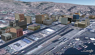
Modeling in Santiago, Chile with Google Building Maker
We should note, however, that geo-modeling with Google SketchUp has been steadily increasing in that region for some time now. For example, avid user gananunez has been modeling in Valparaiso for a year and has more than 50 models in the 3D Buildings layer in Google Earth!

Valparaiso, Chile
Two other long-time users, GecKo StuDio. and Sergio, have been modeling Santiago since 2007 and each has more than 30 models in the 3D Buildings layer. Some users, like jgago93, are just getting started in the area.

Santiago, Chile
Now everyone can help model these two cities with Google Building Maker. Click here to start, and get your models on the 3D map!
Subscribe to:
Posts (Atom)