Friday, July 30, 2010

Find a place for fun in sun with our latest imagery

It's time for another imagery update, and we have a great batch of new data that will help you scout out vacation spots where you can enjoy the height of summer. In our last update, we highlighted an ancient Egyptian temple; and this time, we've got updates of another Sphinx, an exhilarating hydroplane race, and of course, a beautiful summer resort where rest and relaxation await.


Las Vegas

Hydroplane racing

Baja California resort

High Resolution Aerial Updates:
USA: Seattle, Sacramento, San Jose, Las Vegas, Des Moines, Waukegan (IL), Boston, Portland (ME), Tallahassee, and the Florida counties of Sarasota, Levy, Hernando, DeSoto and Martin
Canada: Banff, Alert Bay
Netherlands: Soest, Maarssen, Bussum, Vlaardingen

Countries receiving High Resolution Satellite Updates:
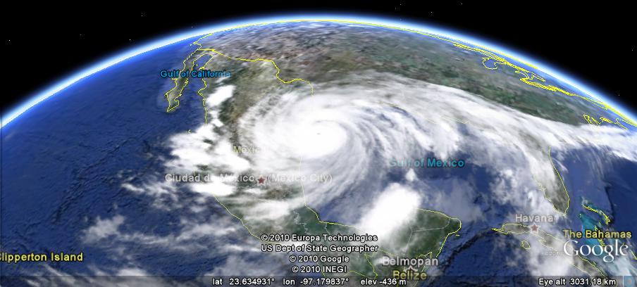
Mexico, Cuba, Jamaica, Haiti, Dominican Republic, Guatemala, Nicaragua, Venezuela, Brazil, Chile, Argentina, Morocco, Algeria, Egypt, Mali, Guinea-Bissau, Guinea, Sierra Leone, Ghana, Democratic Republic of the Congo, Uganda, Burundi, Kenya, Somalia, Malawi, Zimbabwe, Mozambique, South Africa, Madagascar, Turkmenistan, Kazahkstan, Pakistan, India, Bangladesh, China, Mongolia, Russia, Myanmar, Thailand, Malaysia, Indonesia

Countries receiving Medium Resolution Satellite Updates:
Canada, Nepal

Right now these updates are only available in Google Earth, but will be in Google Maps soon. For a complete picture of where we updated imagery, download this KML for viewing in Google Earth.

New weather features in Google Earth 5.2

With all of the great features in Google Earth 5.2, one that often gets overlooked is the great weather enhancements.
The radar layers have been around since late 2007, and they haven't changed a whole lot since then. In March of 2008 they expanded to more countries, giving you satellite and radar imagery for any place that you want to see.
clouds.jpg
With this latest update, they've added a bit more eye candy. If you fly beneath a rainstorm, you'll actually see rain falling in Google Earth! This requires a fairly powerful graphics card, though I don't know the specifics on that.
Turn on the radar, find a green area and watch it rain! If you're not able to see it, here's a screenshot to show you what it's like:
rain.jpg
For more about this, you can read the full entry on the Google Lat Long Blog.

Historical Maps of Scotland

Visualising Urban Geographies

William Edgar, City & Castle of Edinburgh, 1765

Visualising Urban Geographies is a project that aims to bring together historical data provided by Professor Richard Rodger with historical maps provided by the National Library of Scotland. The project's examples website provides access to a very large number of historical maps of Scotland, many of which you can view using the navigational tools of Google Maps.

Maps of Edinburgh, 1765-1945
The Maps of Edinburgh section includes 16 historical maps of Edinburgh from 1765 to 1945. Each of the maps has been overlaid on Google Maps. The maps include a transparency tool so it is easy to compare the maps to the Google Map tiles underneath.

ExMap Viewer

The Exmap Viewer brings together maps from the National Library of Scotland collection and some useful research tools. Features include: adding your own maps and data; Google Street View; bulk geocoding and integration of the Topocoding API.

It is also possible to set up your own instance of the ExtMap viewer using Google Spreadsheets to store your configuration details. Customisable options include: map start point, map layers; bookmarks.

Map and Google Spreadsheets Data Mashup


This is a hugely impressive map viewer that allows you to create your own map mashup with the National Library of Scotland's historical maps and your own geocoded data from Google Spreadsheets.

The viewer includes some example Google Spreadsheet data that geocodes information about tenement plaques in the Marchmont area of Edinburgh. If you wish to add your own data you just need the id number from your Google Spreadsheet.

London's Cycle Scheme on Google Maps

Barclays Cycle Hire Map

London's new cycle hire scheme started today. 5,000 bicycles are available for hire from around 400 special docking stations around the UK capital. Transport for London have produced this Google Map showing the location of the docking stations.

You can search for docking stations by address or just zoom the map to a location. If you click on a map marker you can get live data about the number of bikes currently available at that station.

Nestoria

Real estate website Nestoria think that a property's proximity to cycle hire stations might play a key role in finding your next home. As such, from today you can find all of the central London cycle hire stations on Nestoria.

If you search for property in London you can now view all the cycle stations near a property on a Google Map.

London Cycle Stations Map

I created this map of the cycle hire stations myself for this Fusion Tables tutorial. I've now added the locations of bike shops to the map. So if you don't want to hire a bike you can buy one instead.

The only other map I'm aware of is the Cycle Hire App for the iPhone. The app uses OpenStreetMaps.

Guide Books on Google Maps

GuidebookPlus

GuidebookPlus is a Google Maps based index for travel guidebooks.

GuidebookPlus maps the page numbers of all the places in guidebooks, such as those published by Lonely Planet and Rough Guide. For example is you choose 'Lonely Planet: Italy' from the drop down menu and zoom in on Italy you can see the page numbers on the map relating to each location.

GuidebookPlus includes a number of other functions. If you want to buy a guidebook for your travels you can use GuidebookPlus to find which guidebook has the most places described in a certain area.

As well as quickly finding the location of places mentioned in guidebooks you can get the driving directions from one location to another, find accommodation, read Wikipedia articles and show only places of a given type of interest.

Take the high road or the low road with Earth view in Google Maps

Draggable driving directions is one of our most popular features in Google Maps. By simply clicking on a route and dragging it, you can choose an alternate - perhaps more scenic or more familiar - route to your destination. This feature wasn’t available when Earth view launched in Google Maps earlier this year, but we’re happy to announce that draggable driving directions are now in Earth view as well. After getting directions, just grab the blue route line with your mouse and drag it onto alternate highways or streets. The route will update automatically, redrawing your path in 3D as you move your mouse.

As an example, one of my favorite trips to make is to Yosemite Valley from my home in San Francisco. For those of you familiar with this route, there’s a steep shortcut called Old Priest Grade that saves time but can be challenging for larger vehicles. Here is the recommended route taking the grade:


By grabbing the blue line with your mouse cursor and dragging it within the map, you can quickly and easily pick a different route. In this case, I prefer to go around Old Priest Grade and take the gentler Highway 120.


The next time you plan to drive, whether it’s a short day trip to park you’ve never visited or a weekend road trip with your buddies, make sure to check the route and switch it up if you’d like. You can change these same directions to Yosemite, or click-and-drag any driving route you create!

Thursday, July 29, 2010

Rain or Snow, Now You Can See Weather in Google Earth

It’s the middle of summer, but for those of us who long for the return of cold winter weather and warm cups of cocoa, throw on your favorite poncho and check out the weather in Google Earth 5.2. The latest version projects images of rain and snow over the areas with those weather patterns as it’s actually happening! First enable the clouds layer, then zoom in to a particular location where it might be raining or snowing. I’m willing to bet London is a likely spot, even these days, or the Lone Star state (pictured below) which is in the midst of tropical storm season. Currently, our precipitation data cover some areas in North America and Europe; you can see if it’s available in certain places by enabling the radar layer.


This is a fun and useful tool for anyone planning to travel or who wants to check a specific area where a friend of relative might be visiting or living. For example, in preparation for my recent trip to the American southwest, I decided to check on the status of Hurricane Alex a few days in advance:


Via Google Earth, I could see that the hurricane was entering Mexico and Texas. Zooming close to ground, I saw that the Texas coastline was getting a bit of rain:


Luckily, I missed the hurricane by a couple of days!

You, too, can make like a meteorologist and track wet weather patterns ranging from light drizzle and snow to hurricanes and blizzards in Google Earth. Feel free to give it a try!

3D Satellite View with Google Maps

Stereoluchtfoto's van Amersfoort uit 1932

In July 1932 a plane flew over the Dutch city of Amersfoort and took 160 stereoscopic aerial photographs. Wessel Spoelder has pieced together 32 of these photographs and created this Google Maps mashup.

So if you have your 3D glasses hanging around after viewing Street View in 3Dput them on and check out Amersfoort from above in 3D. If you know Amersfoort you can even search the map by street name.

This is another great Google Map from ab-c media weblab whose panoramicStreet Views of churches in Utrecht is one of the most impressive maps I've seen this year.

The Orient Express Route on Google Maps

London to Istanbul by Train

One of my life's ambitions is to take the train from London to Istanbul following the route taken by the Orient Express. Guardian journalist Benji Lanyado did just that and has created this video map of his journey.

The map itself is just a simple My Map embedded on The Guardian website. The videos however are top-notch and definitely worth watching. They are even better, in my eyes, for having been uploaded to YouTube with the user name pottsy4england (there are bonus points available for the first person who can explain that name in the comments).

The nearest I have got to realising my ambition is creating this Google Map mashup of the route, The Orient Express, featuring a number of videos of cities along the journey. The map is a couple of years old now but still works OK.

Subway Traffic on Google Maps

New York City Subways

Here is another great example from the New York Times of a Google Map created to help illustrate a news story.

Every year, New York City Transit releases a station-by-station breakdown of ridership on the network. This NYT article examines which subway stations experienced a decline in traffic last year and which subway stations experienced growth.

Readers of the New York Times can use the Google Map to query the data themselves. The map gives a great overview of the yearly rises and falls of traffic and users can click on any subway station to view specific traffic data.

The map includes three main views which can be accessed via the menu at the top of the map. You can view a map of where ridership is down, where ridership is up and view the total traffic for the year.

Other New York Times Google Maps

Biking across Poland


GEB reader 'fjk' has recently completed a bicycle trip across much of northern Poland, and he did a great job of tracking the journey and augmenting it with photos and other information.
fjk-trip.jpg
A group of four of them completed to the trek to Swinoujscie, and they used a Garmin 60CSxto track their route.
To view the trip in Google Earth (as seen above), you can simply load this KMZ file. To see more of his adventures, check out his website.
It's great to see people sharing their journeys using Google Earth. If you missed it last month, a few GEB readers used the new "track" feature in 5.2 to show the progress of a 23km race that one of them participated in.
If you've created an interesting track in Google Earth recently, let us know about it and we may feature it in a future post.

World Motor Sports on Google Maps

Rally-Maps.com

Rally Maps uses Google Maps to show the locations of rallies all over the world. Rally Maps also maps a lot of rally videos.

If you click on a rally marker you can then select to view the rally's route marked out on the map. The route includes indicators to show the start and finish locations, spectator locations, the schedule of races and an elevation profile.

Users of Rally Maps can add their own videos to the maps. They can also add their favourite spectator locations for the different rallies.

Ordering Food with Google Maps

Go Mobo

Go Mobo allows users to place online and text message orders at their favorite restaurants.

To place an order diners first have to find which Mobo restaurants are nearby. To do this you just need to enter an address or zip-code. Go Mobo then displays a Google Map of restaurants in your location. The restaurants are also listed in the map sidebar, with the address, distance from your location and opening hours.

If you select a restaurant from the map you can then click through to the restaurant's menu and select what you wish to order. Once you have placed your order all you have to do is turn up, collect your food and eat.

Bike Thefts on Google Maps

Oak Park and River Forest Bike Theft Map

I cycle almost daily. My experience is that I have a bike stolen on average every other year. So over the years I've worked out that in the long run it is probably best to buy only the cheapest bikes in London.

I couldn't agree more then with the The Wednesday Journal of Oak Park and River Forest when they say that the "best way to avoid thefts is to be smart and informed". To help residents in this suburb of Chicago keep informed The Wednesday Journal are creating a Google Map each week to show the locations of bikes stolen

The map shows whether bikes were secured or unsecured when stolen and also shows arrests made related to the theft of a bike. Looking at the map there seems to be a cluster of thefts around South Boulevard. My guess is these are bikes mainly left at subway stations on the Green Line.

Wednesday, July 28, 2010

Microsoft Street Slide - Updated

Google Maps Street Slide


Microsoft Research has developed a pretty cool demo of what they are calling Street Slide. I won't bother describing it as you can see it in action yourself in the video above.

Watching the video I couldn't help thinking that you could produce something very similar with Google Maps Street View. I knocked together this proof of concept in about an hour. I think with a few more hours on this and a little help with jQuery you could actually get something that looked and worked very well.

Update: I've now added a demo for the south side of Oxford Street. The first demo just uses the static images for Street Views and places them side by side.

In this second demo I've tried to stitch the images together. This take a bit more work (with Photoshop), so for now I've only got fours Street Views in this example. So to load the Street Views just click on different parts of the image.

Demo 1
Demo 2

If you think you can develop this further help yourself to the code.

Fund Raising for Diabetes with Google Maps

Zip The Cure

Zip The Cure have created an imaginative fund-raising campaign using Google Maps. The idea behind the campaign is to raise $100 in every zip code to fund research to help find a cure for juvenile diabetes.

To claim a zip-code first go to the Zip the Cure Map to find if your area is still available. If your zip-code isn't available you can always grab one that is. Zip-codes that are already claimed are shaded green and those still available are coloured yellow.

Once you have found a clear location you can donate your $100 by PayPal. If you can't afford $100 you can make a general donation of any sum. 

Alex Trebek, Teachers and Googlers Unite at the Google Geo Teachers Institute

What do Alex Trebek, teachers and Googlers have in common? Last week, these individuals and groups all came together at the Googleplex in Mountain View, CA to celebrate exploration and learning.

Google hosted its first Geo Teachers Institute, an intensive two-day workshop in which 150 educators received hands-on training and experience with Google Maps, Google SketchUp and Google Earth, including features like Mars, Moon and SkyMaps. Attendees from around the globe not only learned how these products work, but also discovered tips and resources for introducing these tools to students and using them to conceptualize, visualize, share and communicate about the world around them. Through this event, teachers were hopefully inspired to bring the world's geographic information to students in compelling, fresh and fun ways.


John Hanke, VP of Product Management, addressing the audience of educators

As part of our continued effort to collaborate with teachers and help students get a better sense of places across the globe, we also announced that Google Earth Pro is now available to educators for free through the Google Earth for Educators site. Educators from higher educational and academic institutions who demonstrate a need for the Pro features in their classrooms can now apply for single licenses for themselves or site licenses for their computer labs. A similar program exists for SketchUp Pro through the Google SketchUp Pro Statewide License Grant, which is currently being provided via grants to 11 states, and available to all others at the K-12 level at no cost.

In conjunction with these exciting Geo-related events and announcements, the Geo Education team also thought it’d be timely and fun to test Googlers’ geographic knowledge by hosting the company’s first ever Google Geo Bee. With help from National Geographic, 68 teams relived their school years and took a written geography exam, competing for a spot on stage with Alex Trebek, who hosted the main event. The competition was based on the group version of the National Geographic Bee for students, which Google has sponsored for the past two years. Questions included those like “Which country contains most of the Balkan Mountains, which mark the boundary between the historical regions of Thrace and Moesia?” and “Ben Nevis, the highest peak in the United Kingdom, is located in which mountain chain?”

The winners of our Google Geo Bee: Ian Sharp, Marcus Thorpe and Rob Harford

The final three Google teams (the Tea-Drinking Imperialists, the Geoids and the Titans) all showed off their geographic literacy and answered a plethora of diverse and complex questions. In the end, it was the Tea-Drinkers who emerged the winners when they figured out that Mecca was the answer to the clue, “Due to this city’s location on a desert trading route, many residents were merchants, the most famous of whom was born around A.D. 570.” And they didn’t just walk away with bragging rights; thanks to Sven Linblad from Linblad Expeditions, they also won an amazing adventure trip to either the Arctic, the Galapagos or Antarctica.

Through all of these education efforts - for teachers, students and grown-up Googlers alike - we hope people of all ages never stop exploring.

Fixing Street-lights with Google Maps

Seattle City Light

Seattle's Streetlight Tracker is a Google Map shows the locations of all the street-lights Seattle City Light are working on and the expected time for repairs.

The map uses coloured map markers to show the length of time the light is likely to take to be repaired. Green markers indicate the light should be fixed within 10 business days, blue markers should be fixed with 45 days and red markers need major work and will be fixed within 120 days.

If you click on any of the map markers you can view the ticket number of the street-light repair. If you know of any other street-lights not functioning in Seattle you can report the light to be fixed.

More building maker cities added; Santiago and Valparaiso, Chile


It's been a while since Google has added any new cities to their Building Maker tool, but now two more have joined the mix - Santiago and Valparaiso, Chile.
Santiago.jpg
These two cities bring the total available in Building Maker up 94. I'm always happy when they expand the coverage to more cities, and I look forward to seeing them expand the coverage area for existing cities a bit further.
Google has pointed out that a few users have been building a lot of models in the area over the last few years. In particular, 'gananunez' has created over 50 models in Valparaiso and users 'GecKo StuDio' and 'Sergio' have been creating various buildings in Santiago for the last few years. Having their buildings in the area will be a great start as other users start to fill in the cities with new Building Maker cities.
valparaiso.jpg
You can read more about the new cities in the Google Lat Long BlogTo try it yourself, simply visit the main Building Maker site.

YouTube News on Google Maps

ABC7new's Channel Google Map

The traditional TV and print media are very keen these days to feature videos and photographs of news events captured by the public. The fact that a large proportion of the population now carry mobile phones with built in cameras means that when something newsworthy happens there is a very good chance that some people on the scene will be taking pictures and videos. The traditional media want those eye witness records.

If you look on the websites of the traditional media you will often find a link to submit your photos and videos. In San Francisco ABC7news have gone one better and teamed up with YouTube to create the ABC7 uReport. ABC7 will use YouTube Direct to collect news footage from people in the San Francisco Bay Area.

Residents of the Bay Area are invited to document the news and events happening where they live, work and play, and to submit those videos via YouTube Direct to the producers at ABC7. ABC7 will then feature newsworthy videos on television (Channel 7 in the Bay Area), on their website, and on theirYouTube channel.

The YouTube channel for ABC7 news and their website both feature a Google Map displaying the submitted newsworthy videos. The videos are categorised into 'breaking news', 'events', 'weather', 'Bay Area scenes'.

Via: YouTube Blog

WikiLeaks War Logs Mapped - Part Three

WikiLeaks War Logs

Having spent a couple of days reporting on Google Map mashups of the WikiLeaks War Logs from Afghanistan I thought I'd have a look at the war logs myself on the WikiLeaks site. Lo and behold it looks like WikiLeaks have themselves mapped all of the 75,000 US military reports covering the war in Afghanistan.

The logs are categorised on the WikiLeaks site by Type, Category, Region, Affiliation, Date and Severity. If you click through to view an individual file you can see the location of the reported incident on a Google Map placed at the bottom of the log.

Næsten 4.000 civile dræbt i Afghanistan

Danish newspaper Ekstra Bladet has been analysing the WikiLeaks War Logs for references to incidents involving the Danish army. They have created a Google Map interface to their findings showing the locations of the references to Danish soldiers.

The mapped incidents are categorised into Enemy Action, Explosive Hazard, Friendly Action, Non-Combat Event and Other. Each category is given its own category of map marker. If you click on a marker you can read the leaked war log in full.

Each information window also has a permanent link. So if you wish to share a particular war log with someone you can give them the link. When the recipient clicks on the link they will be taken to the map and to the open information window of the selected war log.

Hat-tip: Microformats.dk

Also See The Guardian's Maps

Two Chilean cities added to Google Building Maker

For those of you who haven’t yet tried it, Google Building Maker is our simple 3D modeling tool that allows you to construct buildings by aligning various types of blocks to photos - all from your Internet browser. The completed models are automatically geo-located and then reviewed for inclusion in the 3D Buildings layer on Google Earth. When the tool was originally released last fall, users could create buildings in 50 cities. Since then, more cities have continually been added, and the growing tally is now at 94.

As part of our latest offering, we’re excited to announce that the cities of Santiago and Valparaiso in Chile are the first South American cities available in Google Building Maker.


Modeling in Santiago, Chile with Google Building Maker

We should note, however, that geo-modeling with Google SketchUp has been steadily increasing in that region for some time now. For example, avid user gananunez has been modeling in Valparaiso for a year and has more than 50 models in the 3D Buildings layer in Google Earth!


Valparaiso, Chile

Two other long-time users, GecKo StuDio. and Sergio, have been modeling Santiago since 2007 and each has more than 30 models in the 3D Buildings layer. Some users, like jgago93, are just getting started in the area.


Santiago, Chile

Now everyone can help model these two cities with Google Building Maker. Click here to start, and get your models on the 3D map!

Tuesday, July 27, 2010

Afghanistan War Logs Mapped - Part two

Afghanistan War Logs: IED Attacks Map

The Guardian newspaper have created another informative Google Map from the WikiLeaks War Logs from Afghanistan. The Guardian's IED Attacks Map shows the location of 16,000 improvised explosive devices in Afghanistan over 5 years. The improvised explosive device (IED) is the Taliban's weapon of choice.

The map includes an animated timeline. If you press play at the bottom of the map you can watch the data being animated on the map from 2004 to 2009. It is even possible to view what data you wish to view on the map whilst it is being animated. The map includes markers for civilians, coalition troops, Afghan troops and others. You can select to view any combination of the map markers.

On Sunday The Guardian released the Afghanistan: The War Logs Map. The map geotags a selection of 300 of the key intelligence reports from the War Logs.

The Gulf Oil Spill Bird Tracker

eBird Gulf Spill Bird Tracker

eBird have created this Google Map to show bird sightings in the Gulf of Mexico. The map also displays an oil slick forecast for the next four days.

The oil slick forecast is provided by the National Oceanic and Atmospheric Administration. The bird observations are from eBird's own tens of thousands of users. The bird sightings on the map are indicated by red markers for sightings older than 30 days and yellow markers for more recent sightings.

You can change the bird species displayed on the map by clicking the 'more species' button and selecting one of the available bird species.

eBird Global Range Maps

eBird have also created this Google Map that displays a range map for any bird species around the world. There isn't any information available on how the map works but I assume the range maps are created by using the sightings for each species submitted by eBirds users.

To use the map you just need to enter the name of the bird species into the search box. The map will then display a heat map showing locations around the world where the species has been sighted.

Bird Observations
Finally, eBird also let you create a point map for any location, or a seasonal grid maps for the Americas for any bird species using Google Maps.

Other Birdwatching Maps

Google Places team answers questions via YouTube

When Google Places was reintroduced with its new name and additional features earlier this year, we thought it’d be an opportune time to experiment with a new way of engaging with our users. So we launched a Google Moderator page and invited business owners who use Google Places to ask and vote on questions and submit product ideas. Our team also committed to answering the top posts via video.

Many takes later, we’re excited to share eleven new videos that are now live on the Google Places YouTube Channel. While we’re aware that the film quality could be improved, we hope you enjoy putting faces to the names of our forum guides, seeing some of our team’s personalities reflected in the videos, and even getting to hear from a Google intern.

Video responses are a new method of interaction for us, so we’ll track viewership, business owners’ reactions and other factors to determine if this is a useful project we should continue. In the meantime, feel free to watch our most popular video to date about ranking from local product manager Jeremy Sussman, or any of our other video responses.


Happy viewing, and we hope these videos are helpful, informative and interesting for all you business owners using Google Places!

The Geospatial Revolution Project


The folks at Penn State Public Broadcasting are in the middle of creating a series of videos showing how geo-spatial technology is changing the world we live in.
They've released a five-minute video showing some of the content that will be in the series, and it's a great little video. Check it out:


According to their website, they have a list of problems that are aided heavily by geospatial information, such as:
  • fight climate change;
  • map populations across continents, countries, and communities;
  • track disease;
  • strengthen bonds between cultures;
  • defend the nation;
  • assist first responders in protecting safety;
  • enable democracy;
  • navigate our personal lives.
They plan to release the first episode in mid-September of this year, and we'll certainly be keeping an eye out for it. In the meantime, check out their site or follow them on Facebookor Twitter for the latest updates on the status of the project.

Guy Walks Across America - Google Map

The latest YouTube viral video is this amazing timelapse of someone walking across America.


The video is accompanied by a Google My Map of the route. The map includes behind the scene pictures and videos that were shot on the journey from Brooklyn Bridge to the Golden Gate Bridge.

TimeMap Berlin


This Bing Map lets you view historical maps of Berlin. The map features an innovative 'timescope' that you can drag over the modern map of Berlin whilst viewing the historical map through the timescope.

If you wish to view a different historical map of Berlin you can select a date from the bottom of the timescope. It is also possible to adjust the transparency of the historical map to view the modern map beneath. On the right hand side of the map are quick links to some of Berlin's top sights.

TimeMap Berlin

Finding a Health Clinic with Google Maps

Anthem Clinic Locator

Anthem Blue Cross in Virginia say that more than 60 percent of emergency-department visits by Anthem members are actually for non-emergency medical problems. ER wait times are at an all-time high, so patients with non-emergency problems can actually cause delays in doctors treating real emergencies.

To help their customers find medical care quickly when they can’t see their regular doctor Anthem Blue Cross have created a Google Map of health clinics, walk-in doctor offices and urgent care centers. They hope the map will help reduce the number of visits to ER by non-emergency patients.

The map allows Anthem customers to search by address or zipcode. Health clinics, walk-in doctor offices and urgent care centers are shown on the map by categorised map markers. The information window for each facility contains the full address, opening hours and an option to get driving directions.