However this is not the only way to visualise your check-in history. There are actually a few applications that can help you create maps of your check-ins.
Wee Places
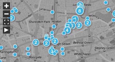
Wee Places is probably the best application I've seen for visualising your foursquare check-ins. I'm not sure what mapping service Wee Places is using, it doesn't look like Google Maps and there is no other map logo.
Wee Places provides a map of your check-ins and a time-line. The map animates through your time-line and zaps a yellow line between your check-ins as the time-line plays.
Once the time-line has come to an end you are left with a map of all your check-ins. The size of the map markers reflects the number of times you have checked-in at a venue and, if that is too confusing for you, the marker contains a number telling you the number of check-ins you made here.
4Mapper
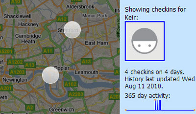
Not so visually attractive but effective none-the-less is 4Mapper. Sign into 4mapper with your foursquare account and you can view your check-ins on a Google Map.
4mapper lets you keep your map private or you can make it public and share your map with the world.
4sq Maps
4sq maps is another application that hasn't gone overboard on the design budget but it does have some very nice features.
4sq Maps uses different coloured map markers to show your check-ins, your mayorships and also shows you where your friends have checked-in. 4sq Maps can also provide a static image of your map so that you can place an image of your map in your own website or blog.
Tripline
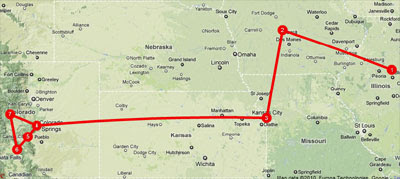
The wonderful Tripline, that I reviewed last week, also has an option to visualise your foursquare check-ins.
Tripline has some wonderful features that do make it a great way to visualise your check-ins. Unfortunately at the moment you can only import your last fifteen check-ins, so it is limited in scope.
Gowalla Walk
Just in case Gowalla users were beginning to feel left out there is one great Gowalla Google Map mashap. Gowalla Walk is a cool Google Map based application that lets you visualise your Gowalla check-ins.
To create your own Gowalla Walk map all you have to do is enter your username. All the places you have checked-in with Gowalla will then be shown on a Google Map. The locations visited are also listed under the map.

