"A trip planner helps you figure out how best to get where you want to go. A multi-modal trip planner lets you plan routes using multiple "modes," for example, on foot, bike, train, bus, or some combination thereof. A good multi-modal trip planner allows you to easily tailor your trip to your preferences, for example by eliminating transfers, walking a more scenic path, or only riding buses with bike storage."
What is OpenTripPlanner?
OpenTripPlanner is an open source multi-modal trip planner. It brings together work from a number of existing open source projects, including Graphserver, OneBusAway, and FivePoints, and aims to be easy-to-use, flexible, reliable, and fast.

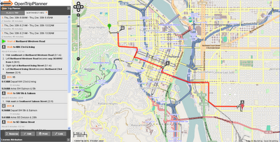
Planning a trip is very straightforward - right click to create start point and right click to add destination.

Lots of Options - like Transit only - with changes includes - clearly laid-out.
For Developers
- Plans true multi-modal trips combining walking, biking and transit
- Plans wheelchair accessible trips
- Plans depart by/arrive by trips
- Takes road type, bike lane, and elevation data into account when planning bike trips
- Show elevation maps for bike trips
- Imports data from GTFS, shapefiles, OpenStreetMap, and the National Elevation Dataset
- Plans trips in about 100ms in a moderate sized city
- Exposes a RESTful API (XML and JSON), which other apps or front-ends can build on
Try the OpenTripPlanner for Portland
http://maps5.trimet.org/otp/
wiki for developers
http://opentripplanner.org/wiki
Labels: OpenStreetMap, OpenTripPlanner, Portland, USA
No comments:
Post a Comment