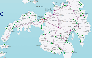
Mindanao is a major island in Philippines and one of the three adiministrative regions of the country (the other two being Luzon and the Visayas). In terms of size it is second only to Luzon island. "The land of promise", as Mindanao is sometimes called, has an estimated population of 21,582,540, making it the second most populous island (compared to Luzon's approximately 45 million inhabitants and the Visayas' approximately 17 million.
The exact size of Mindanao island is 61,077 square kilometers, or 23,582 square miles.


Mindanao is a great place to visit if you keep aware of the political reality of the island. I hope the abovemaps of Mindanao assist you in your research and planning!
No comments:
Post a Comment