Saturday, December 11, 2010
National Geographic Maps USA Explorer Map
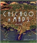
Chicago in Maps: 1612-2002
Real-Time Planes & Ships on Google Maps

This amazing Spanish Google Map seems to have set itself the task of tracking in real-time just about anything that moves. The map shows in real-time the location of ships, planes, mobile phones and satellites in and around and over Spain.
A really nice feature of the map is that as well as viewing the real-time locations of the ships and planes you can select an individual vessel and view an animation of its movements over the last 24 hours. It is also possible to select to view wind speeds and the current weather forecast on the map.
The mobile phone tracking seems to track just the one phone (presumably the map's creator). When I viewed the map it showed only the one track in Burgos. There are also a lot of other features to play with on this map. It shows upcoming boat races in Spain, the locations of weather stations, information from Spanish marinas and the position of satellites.
________________
Open Innovators on Google Maps

The Open Innovations Map is an interactive database of key players in the field of open innovation worldwide. The directory of key players, including detailed information about each member and their network with other subscribers, can be accessed and viewed on a Google Map
The open innovators have been categorised into three groups 'Ideators' (startups, entrepreneurs, developers etc.), 'Scouts' (corporate ventures, business angels etc.) and 'Open Innovators' (corporations, public bodies etc.).
The directory includes a 'User-Generated Content' feature that enables users to join the OIM database by subscribing to the project, and then create a network with other participants.
Friday, December 10, 2010
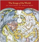
20 Centuries of World Maps
Though technology has changed the tools of navigation available to us, maps are still the irreplaceable foundation of place and orientation. In this updated edition of Image of the World, map expert Peter Whitfield guides readers through a collection of so… more »
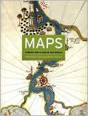
Maps: Finding Our Place in the World
Maps are universal forms of communication, easily understood and appreciated regardless of culture or language. This truly magisterial book introduces readers to the widest range of maps ever considered in one volume maps from different time periods and a… more »
National Geographic Our World: A Child's First Picture Atlas
The National Geographic Society's world-renowned cartographers are proud to present a state-of-the-art world atlas for children ages 3 to 6. This updated edition of the award-winning National Geographic Our World A Child's First Picture Atlas uses a puzzle… more »
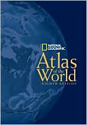
National Geographic Atlas of the World
Combining state-of-the-art cartographic technology with dynamic and diverse cultural content, our award-winning atlas was more than a year in the making. It was developed using advanced Geographic Information Systems (GIS), satellite imagery, and shuttle r… more »
Another Amazing HTML5 Music Video

This HTML5 video from Japanese band Soul River integrates with your Twitter and Facebook accounts and with your webcam to create a truly wild and amazing web musical video.
The video was obviously inspired by The Wilderness Downtown's experimental HTML5 video. Like the Wilderness Downtown video Soul River makes use of numerous browser windows and your geographical location.
Using your browser's geolocation detection capabilities the video displays a Google Map of your location. The Soul River singer is then shown walking across the map. There is a lot more amazing stuff in the full video but really you have to watch it yourself.
To watch the video you will need a browser that supports HTML5. Use Chrome if you have it.
________________
Labels: music
View the 2010 Hurricane Season in Google Earth
Greg at Geodesic contacted us to let us know about a very cool animation that his company has built which provides a great visualization of the 2010 Hurricane Season. Based on theNOAA tropical cyclone track data, this file does a great job of showing all of the hurricanes in 2010.
The file is rather large (9.35MB), but includes fantastic imagery of the various stages of each storm. For example, here is a great image of Hurricane Danielle as it was heading toward Bermuda:
You can read more about this project on their site. To see it for yourself, you can use this KMZ file or watch the video below: