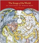
Though technology has changed the tools of navigation available to us, maps are still the irreplaceable foundation of place and orientation. In this updated edition of Image of the World, map expert Peter Whitfield guides readers through a collection of so… more »
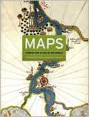
Maps are universal forms of communication, easily understood and appreciated regardless of culture or language. This truly magisterial book introduces readers to the widest range of maps ever considered in one volume maps from different time periods and a… more »
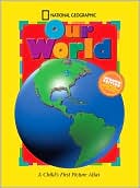
The National Geographic Society's world-renowned cartographers are proud to present a state-of-the-art world atlas for children ages 3 to 6. This updated edition of the award-winning National Geographic Our World A Child's First Picture Atlas uses a puzzle… more »
Combining state-of-the-art cartographic technology with dynamic and diverse cultural content, our award-winning atlas was more than a year in the making. It was developed using advanced Geographic Information Systems (GIS), satellite imagery, and shuttle r… more »
Soul Mirror This HTML5 video from Japanese band Soul River integrates with your Twitter and Facebook accounts and with your webcam to create a truly wild and amazing web musical video.
The video was obviously inspired by The Wilderness Downtown's experimental HTML5 video. Like the Wilderness Downtown video Soul River makes use of numerous browser windows and your geographical location.
Using your browser's geolocation detection capabilities the video displays a Google Map of your location. The Soul River singer is then shown walking across the map. There is a lot more amazing stuff in the full video but really you have to watch it yourself.
To watch the video you will need a browser that supports HTML5. Use Chrome if you have it.
Greg at Geodesic contacted us to let us know about a very cool animation that his company has built which provides a great visualization of the 2010 Hurricane Season. Based on theNOAA tropical cyclone track data, this file does a great job of showing all of the hurricanes in 2010.
The file is rather large (9.35MB), but includes fantastic imagery of the various stages of each storm. For example, here is a great image of Hurricane Danielle as it was heading toward Bermuda:
You can read more about this project on their site. To see it for yourself, you can use this KMZ file or watch the video below:
British Road Casualties 2008 & 2009 Google Maps built with Fusion Tables can support huge amounts of data and can also now support spatial queries. This Google Map of British Road Casualties is an excellent example of a map using Fusion Tables to great effect.
The map shows the location of over 4,500 fatal and serious injuries on British roads for 2008 & 2009. The map also makes great use of queries. It will load the nearest 100 results for any searched location and the map also reloads the nearest markers on the fly as you pan the map around.
As well as these spatial queries it is possible to query the results shown by year of serious injury or fatality.
Google have been testing a new user interface for Google Maps for a couple of months now. The new design seems to have now gone live.
The biggest change is in the appearance of the map buttons. The buttons have been changed to larger thumbnail images. In the new design when you roll over the satellite thumbnail the layer options appear in a drop-down list.
The list of your recent map searches is also displayed in the layer panel.
Hypercities Hypercities is a great collection of historical maps that can be viewed on Google Maps. The site now has historical map collections for 18 cities around the world.
If you select a city from the map the historical maps available for the city will load in the map sidebar. If you select a map from the sidebar you can view the map overlaid on a Google Map of the city.
The transparency of the historical map overlays can be adjusted with the slidebar control. It is therefore possible to compare the historical map with the Google Map underneath.
Last year I wrote about Virtual Village II an online adventure game built on top of the Google Maps API. In the game you are able to move around on a map and interact with other players, with virtual players and with buildings and objects.
Virtual Village II has now been updated with a number of new features. It is now possible to log-in to the game with your Facebook account. The game also now features a number of YouTube cut scenes. When you move around the village there are a number of videos that show the locations of the village in real life.
More villages have also been added to the game and you can move between the different villages. The game now uses Open Layers but also features integration with the Google Earth browser plug-in.
The game supports English and Spanish. Here are some quick tips to help you explore the game world:
1. Walking - you can only walk short distances so click on the map fairly near your game avatar to walk to that position. You can not walk through buildings so stick to the roads.
2. Entering buildings - you can only enter some buildings. The game instructions tell you when you are near a building that you can enter. The instructions point you in the direction of the building and tell you how far away it is. When you are in the right position click enter and then click on the building in the map.
3. Virtual Players - it is important to interact with the virtual players as they can give you objects that you will need later.


 or watch the video below:

