Monday, December 13, 2010

CyberCity 3D Teams with Vixen's L.A. Happy Hours

We've talked about CyberCity3D quite a bit on this blog, with the most recent item being their work on Hidden Los Angeles. They've now taken the technology that was created for that site and have started rolling it out to other sites that could benefit from having a 3D map of their data.

Now tracking down a thirst-quenching happy hour in L.A. is as quick as a click of your mouse. They've toasted to teaming with the popular blog, Vixen's L.A. Happy Hours (vixenslahappyhours.com), to create lahappyhours3d.com.

happy-hour.jpg

Victoria Chandler (a/k/a "Vixen") uncorked her happy hours blog last February with a straightforward buzz: "I'm not a fancy writer... just a girl that likes a good drink." Since then, the blog has spun into an active Facebook page -- and now, its own 3D web portal.

Happyhoursla3d.com features a 3D exploratory portal highlighting happy hour locations (searchable by geographical area), blog reviews, driving directions and more. A cool mobile search app, in its beta testing stage, gives on-the-go followers access to Vixen's happy hour picks and locations.

"I think with the 3D map, my blog will turn into something much bigger than what I originally imagined. I'm just thrilled!" says Vixen's L.A. Happy Hour's Victoria Chandler.
"3D maps like lahappyhours3d.com are a big value add to social websites and their fans, bringing in another dimension to the social graph," states CyberCity 3D CEO Kevin DeVito.

Santa's Google Maps

How Far Does Santa Have to Travel

Have you ever wondered how far Santa Claus has to travel to get to your house? Now you can find out using this Google Map.

Santa holds a huge list of children who have been good throughout the year. This list has the addresses, post codes and ZIP codes of all the children in the world. The population of the world right now is 6,630,000,00. So if 27% of the world's population is below 15 years old then Santa has to visit 1,790,100,000 children (nearly 2 billion).

To work out the most effective route to each child's house Santa uses Google Maps. This year Santa has decided to release the map so that every child in the world can view the route that he will take to reach their house.

This Google Maps application works out the distance between the North Pole and your house. You are also able to view on the map the route Santa will take from the North Pole to your house.

NORAD Santa Tracker


Every year Santa also works with NORAD to provide a real-time Santa tracker using Google Maps and Google Earth.

For more than 50 years, NORAD and its predecessor, the Continental Air Defense Command (CONAD) have tracked Santa’s flight. If you visit the NORAD Santa Tracker on Christmas Eve you can view his live position as he travels around the world.

A New Google Map Creator

Mapfaire

Map Faire is a new Google Map creation tool that is very easy to use to create your own map with its own URL.

To create map markers to your map all you have to do is click 'Add a Point", fill in the information that you want to appear in the information window and drop the pin at the correct location. If you need to adjust the location of a marker you can simply drag it to the correct place on the map.

Once you have added a map marker to the map it is also listed in the map sidebar. When you have finished adding all your markers if you click 'Save Changes' you can then choose a URL for your map, which you can then share with your friends, customers etc.

The app creators are currently working on adding features that will also let you set colours, a logo, marker images and map styles.

________________

Labels:

Sunday, December 12, 2010

National Geographic Atlas of the World, Ninth Edition


National Geographic Atlas of the World, Ninth Edition showcases the Earth in stunning detail, through a magnificent collection of world, continental, and regional maps that represent up-to-the-minute political geography. Throughout the Ninth Edition, state-of-the-art cartographic technologies and thousands of updates deliver accuracy and quality. Innovative new physical and thematic sections address the most compelling issues facing our world today. Preeminent scientists and experts in geographical specialty fields have consulted on all topics, to ensure that the maps, graphs, and text convey significant trends and findings relevant to modern science. Innovative design makes the wide-ranging content wonderfully accessible, resulting in an accurate, useful, and user-friendly reference to the world.Map coverage in the Ninth Edition is more comprehensive and up-to-date than ever before · Newly generated regional maps reveal in great detail the geography of places in the news today, strengthening the reference aspect of the Atlas in its coverage of newsworthy developments, from conflict in the Middle East to global warming in North America.· Dramatic, state-of-the-art ocean floor maps show more detail, more features, and more soundings than in any other atlas.· Extraterrestrial maps chart the Northern and Southern skies, the Solar System, the Milky Way, and the Universe, with new maps of Mars and the Moon that denote physical features, spacecraft landings, and impact sites.Twenty new thematic spreads illustrate crucial aspects of the human and physical world population, urbanization, and their environmental impact, as well as human rights, health and wellness, culture, climate, technology, and many other topics. In this section, world maps appear in the same scale and projection to make it easier for the reader to compare layers of information. Plus, new highlighted notes called "connections" point out the interrelationships between topics. The reference value of the National Geographic Atlas of the World, Ninth Edition is unparalleled, with the place-name index now exceeding 150000 entries to incorporate the thousands of features covered on the new spreads. Simple, straightforward index design provides readers with ease of navigation in finding the places they want to explore.This blend of mapping expertise, comprehensive coverage, and award-winning design places the National Geographic Atlas of the World, Ninth Edition in a class by itself.Free gift The Atlas of the World, Ninth Edition also comes with two free frameable map prints! This premium map is a two-piece, antique-styled map of the Western and Eastern Hemispheres, reflecting current political boundaries. The two sheets can be mounted separately or together in one frame. Dimensions for each sheet are 11-1/2" x 14-5/8".


official site

Viewing Foreclosures on Google Maps


Foreclosures in Detroit

For a long time in the United States you have been able to view real-estate for sale on Google Maps. When searching for property on Google Maps one of the options is to view 'Foreclosures'.

At the end of 2009, more than 13% of US homeowners were either delinquent or in foreclosure. This worrying fact is all too apparent when you use Google Maps to view foreclosures.

The Big Picture has been looking at a number of areas on Google Maps to assess the impact of the downturn on people's homes.

In 2008 USAToday also used the illustrative power of Google Maps and the public records of the foreclosures to highlight the impact the foreclosures are having on Denver.


Each of the houses that have been foreclosed is shaded red on the USAToday produced map.

Hat-tip: All things spatial

Historic Maps and Views of New York


This versatile keepsake presents 24 historic maps and views of New York City that can be removed easily and framed in standard-size frames. Each of these memorable documents, which date from the 17th century to the present, is accompanied by information about its original publication and a brief text that places it in historical context. Library of Congress map expert Vincent Virga has selected maps and views that represent the city in its major transformation; from an early Dutch map to a complete topographical map of Manhattan to stunning overviews of Brooklyn and Queens. An inexpensive portal to a great city's history.


official site

Saturday, December 11, 2010

National Geographic Maps USA Explorer Map


Accuracy and beauty from the cartographers at National Geographic. - An incredibly elegant addition to any home or office. -Mounted on wood material with black beveled edges and a keyhole hanging slot on the back. -Revision Date: 2007 National Geographic Maps - MM620504BL


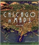
Chicago in Maps: 1612-2002


Chicago in Maps is a luxuriously illustrated cartographic history of Chicago, known for centuries as the gateway city to the West. The powerful and evocative documents reproduced here offer an unprecedented avenue to the city's past-a fascinating collective portrait of the evolution of one of America's great towns. Among the seventy-four maps featured, many are seminal exemplars of this timeless art form the "Kinzie Map," which accompanied the Narrative of the Massacre of 1812; the Rand McNally "View of the World's Columbian Exposition" of 1893; Daniel Burnham's influential "Chicago Plan" of 1909, which epitomized the ambitions of the City Beautiful Movement; WT Stead's "Map of Sin"; and Bruce-Roberts' 1931 "Gangland Map"-a tongue-in-cheek "expos " of a city populated by such powerful underworld figures as Al Capone, "Baby Face" Nelson, "Machine Gun" Kelly, and others, indicating various gang territories and warehouses. Filled with fascinating historical anecdotes and detailed scholarship, Chicago in Maps is a work that will be highly prized by map lovers and history buffs alike. It is a sumptuous feast of glorious full-color reproductions of maps by the some of the world's most extraordinary cartographers

Real-Time Planes & Ships on Google Maps

LocalizaTodo

This amazing Spanish Google Map seems to have set itself the task of tracking in real-time just about anything that moves. The map shows in real-time the location of ships, planes, mobile phones and satellites in and around and over Spain.

A really nice feature of the map is that as well as viewing the real-time locations of the ships and planes you can select an individual vessel and view an animation of its movements over the last 24 hours. It is also possible to select to view wind speeds and the current weather forecast on the map.

The mobile phone tracking seems to track just the one phone (presumably the map's creator). When I viewed the map it showed only the one track in Burgos. There are also a lot of other features to play with on this map. It shows upcoming boat races in Spain, the locations of weather stations, information from Spanish marinas and the position of satellites.

________________

Open Innovators on Google Maps

Open Innovations Map

The Open Innovations Map is an interactive database of key players in the field of open innovation worldwide. The directory of key players, including detailed information about each member and their network with other subscribers, can be accessed and viewed on a Google Map

The open innovators have been categorised into three groups 'Ideators' (startups, entrepreneurs, developers etc.), 'Scouts' (corporate ventures, business angels etc.) and 'Open Innovators' (corporations, public bodies etc.).

The directory includes a 'User-Generated Content' feature that enables users to join the OIM database by subscribing to the project, and then create a network with other participants.