Friday, November 5, 2010

Dangerous Companies on Google Maps

Risikovirksomheder

Danish journalist Nils Mulvad has created a Google Map which shows the location of 170 dangerous Danish companies. The companies have been designated dangerous by the Danish authorities because they process chemicals, fireworks or produce weapons etc.

At first the authorities refused to release the list but Nils submitted a Freedom of Information request and the government were forced to hand it over. Nils has now published the list and this map of the companies - it is the first time the list of companies has been published in Denmark.

Nils has also published an open Google Fusion Table of the data, here.

Via: www.microformats.dk

Tokyo Shopping on Google Maps

Interactive Akihabara Map

Eric Delattre recently moved to Tokyo. He quickly fell in love with the Akiba district of Tokyo. Akihabara is a major shopping area for electronics, computers, anime, and otaku goods. However Eric was disappointed because he couldn't find a good guide to the shops, restaurant and bars in the area so he decided to develop this Google Maps based guide to the area.

The map shows the locations of all the best places in Akihabara. The locations are categorised so it is possible to refine the markers shown on the map by computer / electronics. anime / Manga, restaurants etc.

Like many areas in Japan the best shops are often hard to find, for example they may be found on the 6th floor or behind a small hard to find door. Therefore Eric has included a function that allows anyone to add locations to the map.

Thursday, November 4, 2010

Google Map of Your Twitter Followers

MapMyFollowers

Do you want to know where your followers on Twitter live? Log-in to MapMyFollowers with your Twitter account and you can view a Google Map showing the location of all the people who follow you.

The screenshot above represents the geographical distribution of people who follow my @KeirClarke Twitter account. I'm pretty happy with the distribution. I'd like a few more followers from the southern hemisphere and I don't know what I've done to upset the Japanese. I seem to have upset all but one of the Japanese population, judging by my one Japanese follower.

As well as showing you a map view of your followers you can view a word-cloud of 'common follower terms'. You can also click on any of your followers and view a Google Map showing the location of their followers.

________________

Labels:

Using Styled Maps with the Static Maps API

" layout="standard" show_faces="true" width="450" action="like" colorscheme="light">Ugly Map

My first play with the new Styled Maps feature in the Static Maps API is this ugly map.

This map uses eight static maps with different styles applied to each map. I think you'll agree this is one ugly map.

We Fade to Grey

This one is a little more attractive (but no more useful).

Again the map contains eight static maps with different styles applied to each. This time the colour is gradually taken away in each map to end up with the last map tile being entirely grey-scale.

Flashing Map

In this one I've used the same map styles as in the previous example, only this time I've animated through the images to create a flashing map.

It's a strange effect that I can't really seeing having much practical application.

Zoom in Static Map

I've long admired the use of static maps on Flickr. On Flickr geo-tagged photos are accompanied with a small static map that when you mouseover zooms in on the location.

I've tried to create something similar with this example. If you roll over the map with your mouse the map will zoom in. To achieve this I've just used two static maps with the same map style. One map however has been set to a higher zoom. When you rollover the first map a bit of javascript replaces the zoomed out static map with the zoomed in static map.

________________

Labels: ,


Find an Apartment with Google Maps

MyApartmentMap

The apartment search engine MyApartmentMap officially launched yesterday.

MyApartmentMap was originally created in 2006 as a simple mashup of real estate and Google Maps to help its creator find an apartment in Boston. MyApartmentMap now provides detailed rental data for over 70,000 locations including states, cities, colleges, neighborhoods, military bases, and zip codes. Its database contains over 400,000 apartments from all 50 states.

Using MyApartmentMap users can search and view apartments with the help of Google Maps. It is possible to refine a search by location, price and number of bedrooms. Nearby grocery stores, restaurants, schools, and other points of interest can also be seen with the click of a button.

________________

Labels: ,

Wednesday, November 3, 2010

Guess the Photo with Google Maps

Photo Location Game

In this Google Map game you have to guess where in the world a photograph was taken. Each photograph shows the view from someone's window and all you have to do is guess where the photo was taken.

A grid has been placed over the map and you have to click on the grid square which you think contains the location of the view. If you guess wrong the square will be shaded red. If you guess right the map will zoom in one level and you then need to guess again.

With each correct guess you narrow down your hunt and get closer to finding the exact location of the picture. However you only have 50 guesses in all to win the game. There are three different views to find.

_____________

Labels:

Google Map of London Coffee Houses

London Coffee Houses of the 17th & 18th Century

Inspired by the recent Atlas of the Rhode Island Book Trade I decided to create a map of the London Coffee Houses of the 17th & 18th centuries.

In their heyday there were over 2,000 coffee houses in London. Much has been written about the importance of the coffee house as providing a public sphere for discussion and debate that was largely free from class distinction. Many of modern day London's most important institutions were formed from meetings that first took place in the coffee houses of this time, including the Stock Exchange, Lloyds of London and the Royal Academy.

This Google Map shows the (often approximate) location of some of the most influential of the coffee houses of the 17th & 18th centuries. In creating the map I used Esa's Google Maps API v3 Sidebar with makeMarker() template. I used the Styled Maps function to make the map grey-scale and for the markers I used an image from google-maps-icons.

China’s Map World uses DigitalGlobe imagery

A quick update on China’s newly launched Map World: Chinese neogeographer William Long has posted a review of Map World on his blog (English translation), wherein he notes that at least some of the imagery in Map World is gleaned from American satellite imaging company DigitalGlobe: William compared Map World’s imagery of Tiananmen to Google Earth’s historical imagery archive and found identical imagery from DigitalGlobe dated Feb 9, 2007. (He posts comparison screenshots.) Google Earth, meanwhile, carries imagery from as recently as Nov 8, 2009.
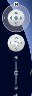
But he makes the most surprising discovery when he manages to get the 3D viewer to work: Map World’s 3D navigation tool bears more than a passing resemblance to Google Earth’s own, in terms of style:
genav.jpg mapworldnav.jpg
Can you tell which is which?
(Screenshot. Seriously now, not even an attempt to camouflage the ripoff? Still, what is Google going to do, sue the Chinese government?)
His other point worth mentioning: the 3D view doesn’t actually do 3D. It doesn’t render elevation. It is merely the 2D imagery projected onto a sphere. The one advantage over 2D: The 3D imagery doesn’t suffer the 2D imagery’s north-south compression due to Map World’s funky projection.
[Update 15:54 UTC: China's State Bureau of Surveying and Mapping has now clarified its earlier statements, to the effect that while the software powering Map World is wholly Chinese, the imagery is indeed purchased from DigitalGlobe. I didn't think this was an issue, but apparently many Chinese users were under the impression that the service was completely home-grown.]

Google Maps: Still doomed in China

The tech news channel of the Chinese portal Sina.com.cn today carries a news update on the legal status in China of ditu.google.cn, the version of Google Maps intended for mainland Chinese users. The original is here; I used the occasionally hilarious Google translation.
In short, things are still not looking up for Google. Sina’s article references government sources who state that Google will definitely not get its license by the end of the year, when China’s laws on internet mapping will begin being enforced in earnest. The implication is that the site will thenceforth be blocked in China.
The proffered reasons are two-fold:
1. The mapping server must be located in China, and the server’s IP address must be shared with the government. The article implies this is not currently the case.
2. Organizations providing web-based maps in China must be joint ventures. Google’s operations in China are not.
The first reason is a bit puzzling: The IP address for ditu.google.cn is listed as being203.208.39.99, which is in Beijing. Still, it’s possible this is the Chinese node of a relay connecting a server physically located in the US. Perhaps the IP address of the originating “server” is opaque for technical reasons — for example, it might be a service distributed across Google’s many server farms — in which case providing a single public IP address to the Chinese government isn’t possible. But I’m speculating.
Note that the above objections do not mention map borders that are not in accordance with Chinese law or the presence on the maps of unvetted user-generated content. That’s because ditu.google.cn’s map borders have long complied with Chinese law, while the site eschews any and all user-generated features, in order to avoid having to censor them.
It’s also possible that this article is a negotiating ploy — making sure the government’s demands are stated publicly so it is clear they are not negotiable. In that case, the intention is still to get Google to form a joint venture and host its Chinese map server on Chinese soil. If plans are not already afoot to make this happen, it is unlikely to be ready by January 2011.
I’ve previously argued that the continued existence of ditu.google.cn is inconsistent with Google’s decision to stop censoring its search services in China, and that the service should be killed off. One way to do so would be for Google not to comply with these new regulatory demands. And that seems indeed to be Google’s current path.
Sina’s article mentions that Microsoft is also not on the list of approved web mapping licensees, for its Chinese version of Bing Maps (at cn.bing.com/ditu). That mapping service does not have the ubiquity of Google Maps, however — for example as the default service for the iPad and iPhone, which are proving wildly popular in China. iPhones sold in China have their default map app locked to ditu.google.cn. What happens if that site is no longer available in China?
It’s not a stretch to infer that the hardening of web mapping regulations in China is coordinated with the timely launch of Map World, a robust government-run web mapping service. Can’t get Google Maps anymore in China in 2011? There will be Map World — just don’t hold out any hope for an API so that you can add user-generated content on your own website. In China, neogeography is not an approved pursuit.
(It will be interesting to see what happens to Google Earth’s accessibility in China in 2011.)

Overheard in New York on Google Maps

Overplot

Here is an oldie that should brighten up your day. Overplot last featured on Google Maps Mania over four years ago but is as funny as ever.

Overplot maps funny conversations overheard in New York and posted toOverheard in New York. Each conversation posted has a fairly precise location attached so Overplot is able to display the conversations on a Google Map of New York.

If you are interested in how the map was created there is also a lengthy explanation at persistant.info.